The Google maps can be a bit temperamental! Follow the instructions below if you find the interactive map too confusing!

The map pictures on the George’s Gazetteer website are just images which link to the central google map. Click on the images to connect to Google Earth
If you click on the map and it loads too much information, follow the instructions below to cut down what is displayed.


The arrow in the top left of the screen will take you to a list of projects.
You can switch between the projects. For ALL locations chose Lockwood & Co All Locations. For the smaller tours, chose Tours. You can toggle whether these projects are available by clicking on the eye icon.

An open eye means the project is visible. A line through it means it is hidden.

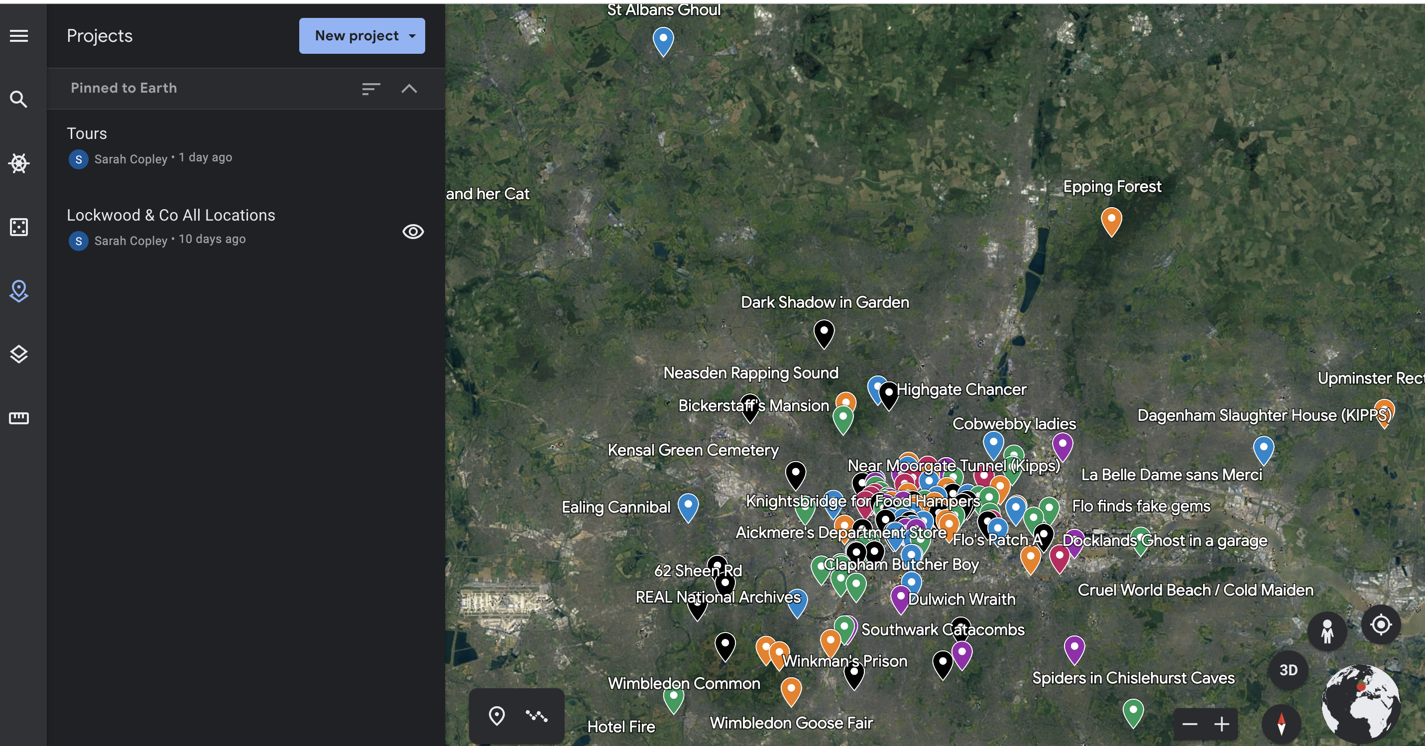
Here, for instance, only the sites on the “Lockwood & Co All Locations” project are visible.
When you click on “Lockwood & Co All Locations”, it expands the project to list all the layers.


Clicking on the little down arrow to the left of the layer name will close the layer. Here The Screaming Staircase layer is closed. The Whispering Skull is open.
And here, ALL the layers are closed.


You can choose which layers you see on the map in a similar way to when you chose which project. Just click on the eye icon next to the layers.
Currently, the layers are all visible.
Now, only the Creeping Shadow and The Empty Grave layers are visible.


You can remove non-Lockwood related map information by selecting “Map Style” from the left panel, and then clicking on “Clean”


Clicking on the arrow next to Map Style on this screen will also expand the map to fill the whole screen.


You can switch to 3D mode in the bottom right hand corner. (Clicking on the screen will stop the view spinning!)
Then you can zoom in!

